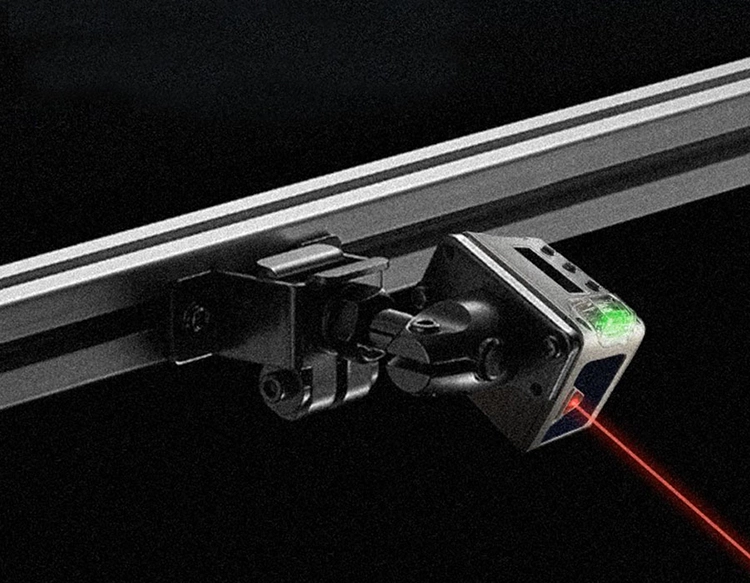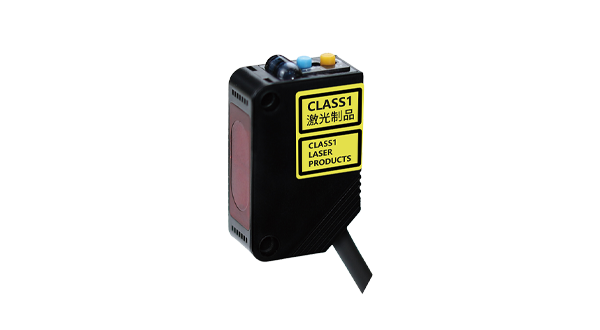


Lidar (Light Detection and Ranging) laser distance sensors have revolutionized how we measure, map, and perceive the world around us. By emitting laser pulses and calculating the time it takes for the light to reflect back from a target, these sensors provide highly accurate distance measurements. Unlike traditional measurement tools, lidar systems can capture millions of data points per second, creating detailed three-dimensional representations of environments. This technology operates on a simple principle: light travels at a constant speed, so the time delay between emission and return of the laser signal directly correlates to distance. Modern lidar sensors utilize advanced components like pulsed lasers, sensitive photodetectors, and precise timing circuits to achieve millimeter-level accuracy even over long ranges.
The evolution of lidar technology has been driven by improvements in laser efficiency, detector sensitivity, and data processing algorithms. Early lidar systems were bulky and expensive, limited to specialized applications such as atmospheric research and topographic surveying. However, recent advancements in semiconductor lasers and MEMS (Micro-Electro-Mechanical Systems) mirrors have led to the development of compact, affordable, and robust lidar sensors. These innovations have expanded lidar's reach into diverse fields, enabling real-time, high-resolution data acquisition in dynamic settings. Today, lidar laser distance sensors are integral to both industrial and consumer applications, offering unparalleled precision and reliability.
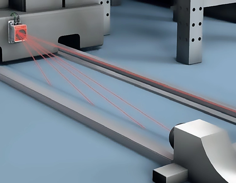
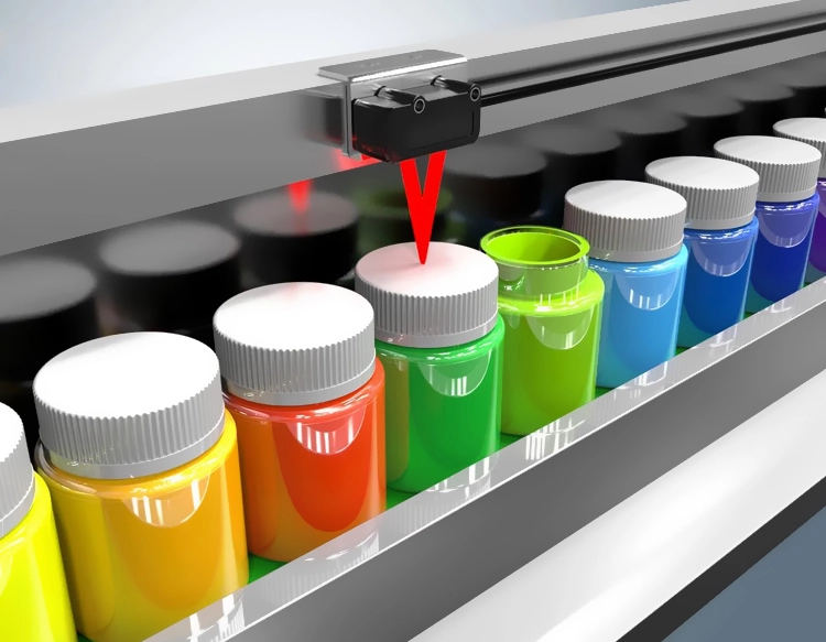
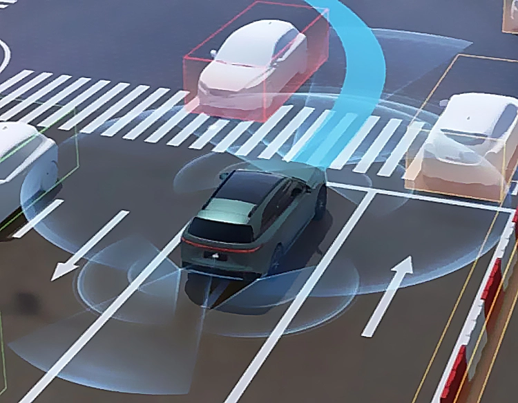
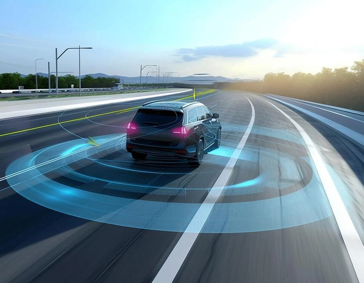
In autonomous vehicles, lidar sensors serve as the eyes of self-driving cars, continuously scanning the surroundings to detect obstacles, pedestrians, and other vehicles. By generating a precise 3D point cloud of the environment, lidar helps navigation systems make split-second decisions to ensure safety. Similarly, in robotics, these sensors enable machines to navigate complex spaces, avoid collisions, and perform tasks like object manipulation or inventory management in warehouses. The construction and surveying industries rely on lidar for accurate land mapping, building inspections, and volume calculations, reducing human error and saving time. Additionally, lidar is used in agriculture for monitoring crop health, optimizing irrigation, and automating machinery, leading to increased efficiency and yield.
Environmental monitoring and archaeology also benefit from lidar's capabilities. Airborne lidar systems can penetrate dense forest canopies to reveal hidden archaeological sites or map terrain features affected by erosion or deforestation. In urban planning, lidar data assists in creating digital twins of cities, facilitating infrastructure development and disaster management. The technology's versatility extends to consumer electronics, with some smartphones now incorporating miniaturized lidar sensors for enhanced photography and augmented reality experiences. As lidar becomes more accessible, its applications continue to grow, pushing the boundaries of what's possible in data-driven fields.
Despite its advantages, lidar technology faces challenges such as high costs for premium systems, sensitivity to weather conditions like fog or heavy rain, and data processing demands. Researchers are addressing these issues by developing solid-state lidar, which has no moving parts for greater durability, and algorithms that filter noise to improve performance in adverse environments. The future of lidar laser distance sensors looks promising, with trends pointing toward further miniaturization, integration with other sensors like cameras and radar, and AI-enhanced data analysis. As these advancements unfold, lidar is set to become even more ubiquitous, driving innovation in automation, smart cities, and beyond, ultimately transforming how we interact with our world through precise, real-time spatial awareness.