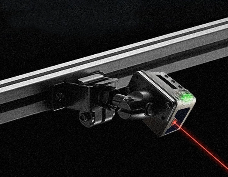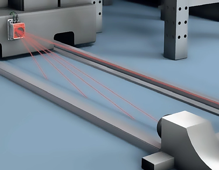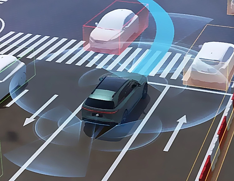


Precision lidar technology has emerged as a transformative force across multiple industries, offering unparalleled accuracy in distance measurement and 3D mapping. By emitting laser pulses and analyzing their reflection, lidar systems generate detailed point clouds that represent the physical environment with millimeter-level precision. This capability is driving innovation in autonomous vehicles, where real-time, high-resolution data is critical for navigation and obstacle avoidance. Automotive manufacturers integrate precision lidar sensors to enhance safety features, enabling vehicles to detect pedestrians, cyclists, and other objects even in low-light conditions. Beyond transportation, the technology plays a vital role in environmental monitoring, such as tracking deforestation, coastal erosion, and glacier retreat. Surveyors and engineers rely on lidar for topographic mapping, infrastructure inspection, and construction planning, significantly reducing project timelines and costs. In archaeology, it reveals hidden structures beneath dense vegetation, uncovering historical sites without invasive excavation. The agriculture sector benefits from precision lidar through optimized crop management, where sensors assess plant health and soil conditions to improve yield. As the technology advances, miniaturization and cost reduction are expanding its accessibility, fostering new applications in robotics, urban planning, and disaster response. However, challenges remain, including data processing complexity and sensitivity to weather conditions like fog or heavy rain. Ongoing research focuses on enhancing algorithmic efficiency and developing hybrid systems that combine lidar with cameras or radar. With continuous improvements in sensor resolution and processing power, precision lidar is poised to become even more integral to smart cities, industrial automation, and scientific exploration, shaping a future where accurate spatial data underpins decision-making across domains.