


Long range LiDAR (Light Detection and Ranging) technology has emerged as a transformative tool across multiple sectors, enabling precise distance measurement and high-resolution 3D mapping over vast areas. Unlike traditional short-range sensors, long range LiDAR systems can detect objects and terrain features from distances exceeding 200 meters, with some advanced models reaching up to several kilometers. This capability is achieved through pulsed laser beams that calculate the time taken for light to reflect off surfaces, generating accurate spatial data even in challenging environmental conditions.
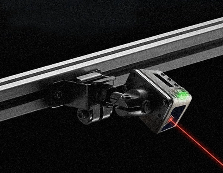
The core components of a long range LiDAR system include a laser emitter, a sensitive receiver, and a high-speed scanning mechanism. Modern systems often utilize 905nm or 1550nm wavelength lasers, with the latter offering enhanced eye safety and better atmospheric penetration. Innovations in solid-state LiDAR and MEMS-based scanning have reduced costs and improved durability, making long range solutions more accessible for commercial use. These systems typically achieve angular resolutions below 0.1 degrees and can operate effectively in rain, fog, or low-light scenarios due to adaptive filtering algorithms.
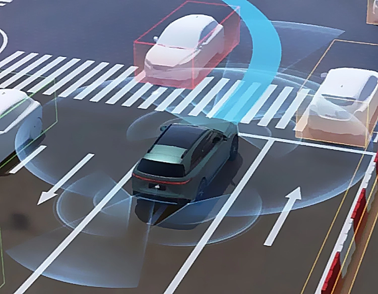
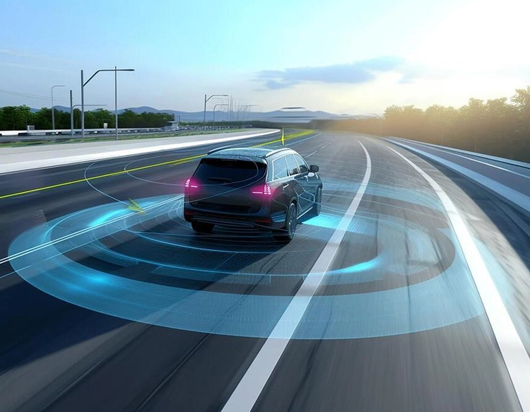
In the automotive industry, long range LiDAR is a cornerstone of autonomous vehicle development. It provides real-time, high-fidelity perception of road geometry, vehicles, and pedestrians at highway speeds, complementing radar and camera systems. Companies like Waymo and Luminar integrate long range LiDAR to enable Level 4 autonomy, where vehicles can navigate complex urban environments without human intervention. The technology’s ability to create detailed point clouds helps in predicting object trajectories and planning safe navigation paths, significantly reducing accident risks.
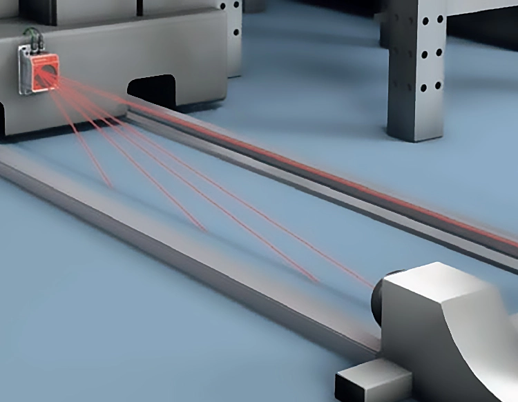
Beyond transportation, long range LiDAR plays a critical role in environmental monitoring and infrastructure management. Forestry agencies use airborne LiDAR surveys to assess canopy height, biomass, and deforestation patterns across thousands of square kilometers. In renewable energy, wind farm operators employ ground-based long range LiDAR to measure wind profiles and optimize turbine placement for maximum efficiency. Civil engineers leverage it for bridge inspection, power line monitoring, and coastal erosion tracking, where manual surveys would be time-consuming and hazardous.
The aerospace and defense sectors also heavily rely on long range LiDAR for terrain mapping, target acquisition, and autonomous drone navigation. Military applications include border surveillance, missile guidance, and reconnaissance missions, where accuracy and range are paramount. Meanwhile, in archaeology, researchers utilize airborne long range LiDAR to uncover hidden ruins beneath dense vegetation, revolutionizing site discovery without invasive digging.
Despite its advantages, long range LiDAR faces challenges such as high power consumption, data processing complexity, and interference from ambient light. Ongoing research focuses on developing AI-driven point cloud compression, multi-sensor fusion techniques, and quantum LiDAR prototypes to extend range and resolution further. As costs decline and integration simplifies, long range LiDAR is poised to expand into smart cities, agriculture robotics, and disaster response, solidifying its status as a key enabler of the digital transformation era.