


LiDAR sensors have become a cornerstone of modern technology, enabling advancements in autonomous vehicles, robotics, mapping, and environmental monitoring. At the heart of their functionality lies a critical parameter: the range of LiDAR sensors. This range refers to the maximum distance at which the sensor can accurately detect and measure objects, a factor that directly influences performance across various applications. Understanding how this range is determined, its limitations, and its real-world implications is essential for engineers, developers, and technology enthusiasts alike.
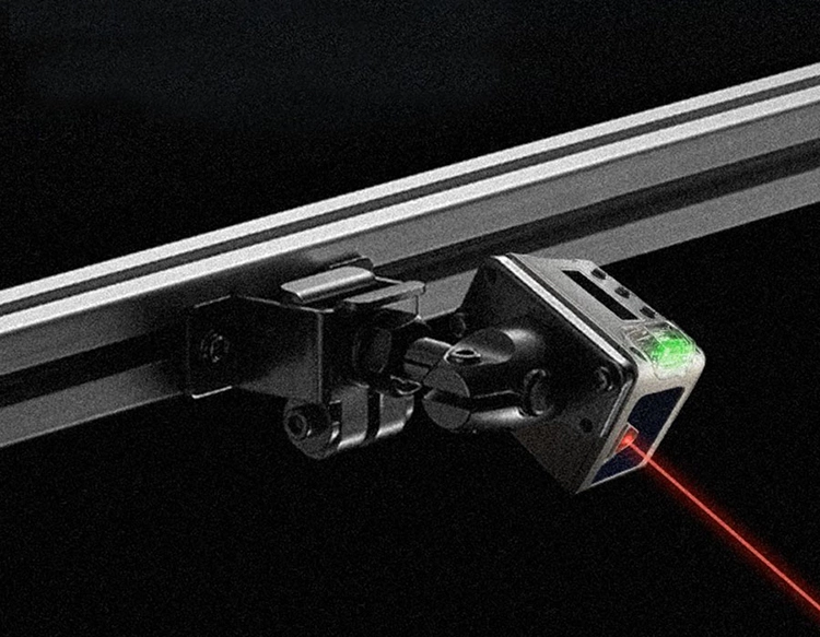
The range of a LiDAR sensor is primarily governed by its ability to emit laser pulses and capture the reflected signals. When a laser beam is directed toward an object, it bounces back to the sensor, and the time taken for this round trip is measured to calculate distance. However, several factors can limit this process. The power of the laser source plays a significant role; higher-powered lasers can travel farther and maintain signal integrity over longer distances. Yet, safety regulations often cap laser power to protect human eyes, imposing a practical constraint on range. Additionally, the reflectivity of the target surface affects range. Bright, reflective materials like metal or white paint return stronger signals, allowing for longer detection distances, while dark or absorbent surfaces, such as asphalt or foliage, may reduce effective range. Environmental conditions, including fog, rain, or dust, can scatter laser beams, further diminishing range and accuracy.
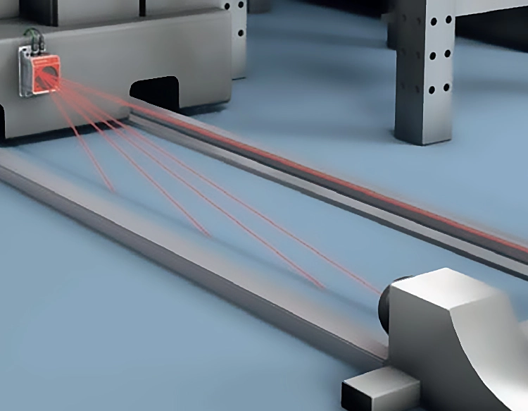
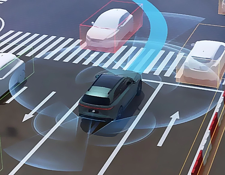
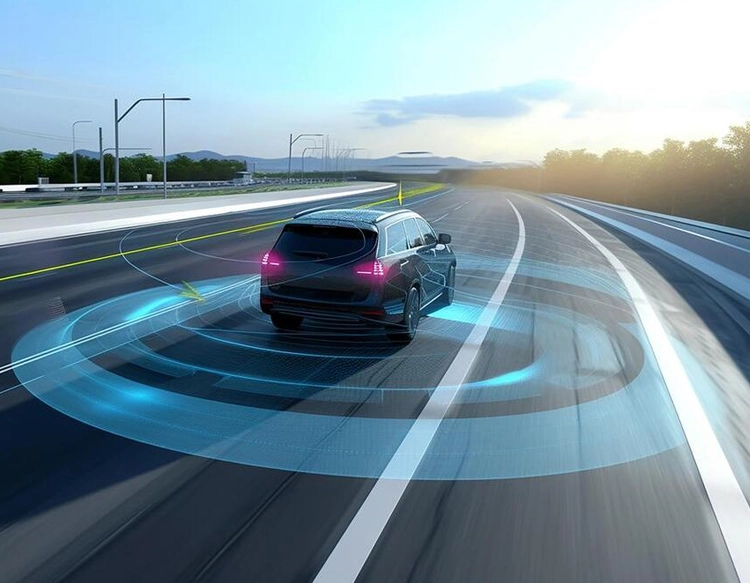
In practical terms, the range of LiDAR sensors varies widely depending on their design and intended use. Short-range LiDAR, often used in robotics or indoor navigation, typically covers distances up to 30 meters, providing high-resolution data for close-proximity tasks. Medium-range sensors, common in advanced driver-assistance systems (ADAS), extend to about 150 meters, helping vehicles detect obstacles and pedestrians in urban settings. Long-range LiDAR, crucial for autonomous driving on highways, can reach over 250 meters, enabling early reaction to distant hazards. For specialized applications like aerial surveying or forestry, some LiDAR systems boast ranges exceeding 1,000 meters, though these often require optimized conditions and higher power outputs.
The impact of LiDAR range on technology is profound. In autonomous vehicles, a longer range allows for smoother navigation at high speeds, as the system gains more time to process and respond to road conditions. Conversely, insufficient range might lead to abrupt maneuvers or safety risks. In agriculture, LiDAR with moderate range helps monitor crop health and terrain, while in archaeology, long-range sensors uncover hidden structures from above. As demand grows, manufacturers are innovating to extend range without compromising safety or cost. Techniques like signal processing algorithms and multi-beam designs enhance detection capabilities, pushing the boundaries of what LiDAR can achieve.
Despite these advancements, challenges remain. Extending range often increases sensor size, power consumption, and expense, making it less feasible for consumer-grade devices. Researchers are exploring solid-state LiDAR and frequency-modulated continuous-wave (FMCW) technology as potential solutions, offering improved range and resilience to interference. As LiDAR evolves, its range will continue to shape the future of automation, smart cities, and beyond, underscoring the importance of this key metric in driving technological progress.