


LiDAR, which stands for Light Detection and Ranging, is a remote sensing method that uses pulsed laser light to measure variable distances to the Earth. This technology creates precise, three-dimensional information about the shape of the Earth and its surface characteristics. A LiDAR sensor emits rapid pulses of laser light towards a target—be it the ground, a forest canopy, or a moving vehicle. The sensor then measures the time it takes for each pulse to bounce back. Since the speed of light is a known constant, these time measurements are translated into exact distances. By compiling millions of these distance points, a highly detailed and accurate 3D model, known as a point cloud, is generated.
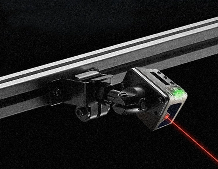
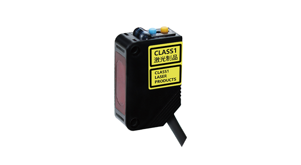
The core components of a LiDAR system include a laser, a scanner, and a specialized GPS receiver. The laser generates the light pulses. Common types used are fiber lasers or diode-pumped solid-state lasers, chosen for their reliability and precision. The scanner directs these pulses across the target area. The speed of the scanner dictates the density of the collected data points. The GPS receiver precisely records the sensor's location, which is crucial for georeferencing the data. An Inertial Measurement Unit (IMU) is also vital, as it tracks the sensor's tilt and orientation during flight or movement, ensuring spatial accuracy.
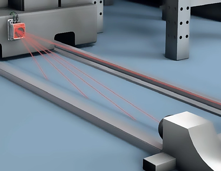
LiDAR technology is primarily categorized into two types based on its platform: Airborne and Terrestrial. Airborne LiDAR is mounted on drones, helicopters, or airplanes. When mounted on an aircraft, it is often referred to as Airborne Laser Scanning (ALS). This type is extensively used for topographic mapping, forestry management, and urban planning. It can penetrate vegetation canopies to model the ground surface below, which is invaluable for archaeologists and geologists. Terrestrial LiDAR, on the other hand, is ground-based. It includes Mobile LiDAR Systems (MLS) mounted on moving vehicles for highway and railway mapping, and Static Terrestrial Laser Scanning (TLS) used for detailed surveys of structures, industrial sites, and crime scenes.
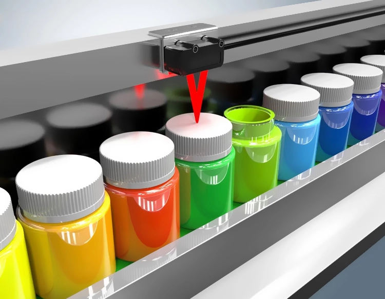
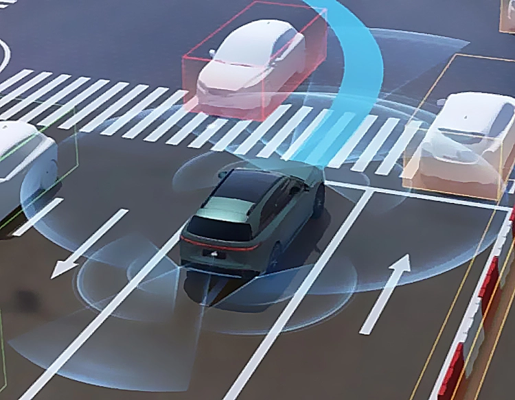
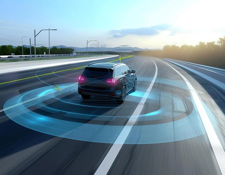
The applications of LiDAR sensors are vast and transformative across numerous industries. In autonomous vehicles, LiDAR is a critical perception tool. It creates a real-time 3D map of the vehicle's surroundings, allowing it to detect pedestrians, cyclists, other vehicles, and road boundaries with high precision, especially in low-light conditions where cameras may struggle. In environmental science and forestry, LiDAR is used to estimate biomass, monitor deforestation, and model flood risks by providing detailed terrain models. The archaeology field uses it to discover hidden structures beneath dense foliage, as seen in famous discoveries in Central American jungles. Furthermore, in construction and surveying, LiDAR enables rapid as-built documentation, volume calculations, and monitoring of structural deformations with millimeter accuracy.
Compared to other sensing technologies like radar and photogrammetry, LiDAR offers distinct advantages. Radar uses radio waves and is excellent for long-range detection and velocity measurement, especially in adverse weather, but it typically offers lower spatial resolution than LiDAR. Photogrammetry creates 3D models from overlapping 2D photographs. While cost-effective, its accuracy can be dependent on lighting conditions and it struggles to model areas under dense vegetation. LiDAR's active illumination—using its own light source—allows it to operate day or night and to penetrate gaps in vegetation, providing more consistent and detailed geometric data.
The future of LiDAR is geared towards miniaturization, cost reduction, and enhanced performance. Solid-state LiDAR, which has no moving mechanical parts, is emerging as a more durable and affordable solution, particularly for the automotive industry. Advances in semiconductor technology and signal processing are making sensors smaller, more powerful, and less expensive. Researchers are also working on increasing the range and resolution while decreasing power consumption. As these trends continue, LiDAR integration will expand into more consumer applications, such as in smartphones for advanced augmented reality experiences and in robotics for sophisticated navigation and object manipulation.
In summary, a LiDAR sensor is a powerful tool for capturing the physical world in exacting digital detail. By measuring distances with laser light, it generates accurate 3D representations that drive innovation in automation, environmental management, and scientific discovery. Its ability to provide precise, reliable data regardless of ambient light conditions sets it apart as a cornerstone technology for the mapping and perception needs of the modern world.