


Lidar distance sensors have emerged as a pivotal technology in various sectors, revolutionizing how we measure, map, and interact with the physical world. These sensors utilize laser pulses to calculate distances by measuring the time it takes for light to reflect off objects and return to the sensor. This principle, known as time-of-flight, enables high-precision measurements that are critical for applications ranging from autonomous vehicles to environmental monitoring. Unlike traditional radar or ultrasonic sensors, lidar offers superior resolution and accuracy, making it indispensable in fields where detail and reliability are paramount.
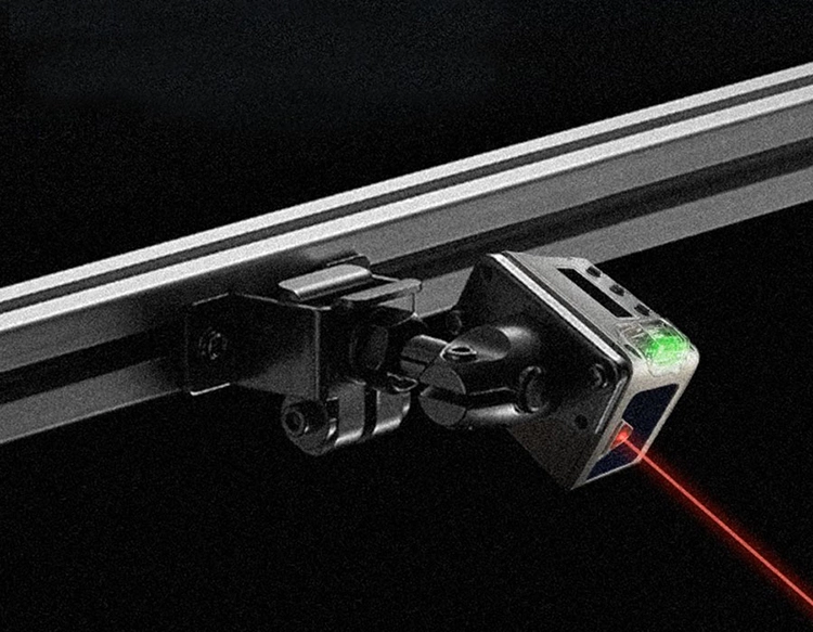
The core components of a lidar distance sensor include a laser emitter, a scanner, and a photodetector. The laser emits focused light beams that scan the environment, while the scanner directs these beams across a specific area. When the light hits an object, it reflects back to the photodetector, which converts the signal into electrical data. Advanced algorithms then process this data to generate detailed 3D point clouds or distance readings. Modern lidar systems often incorporate solid-state designs, eliminating moving parts to enhance durability and reduce costs. This evolution has led to more compact and efficient sensors, broadening their adoption across industries.
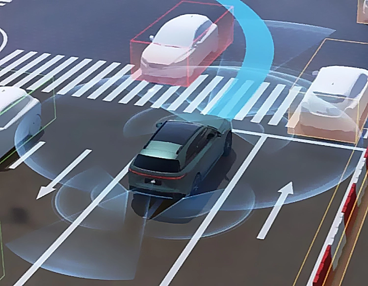
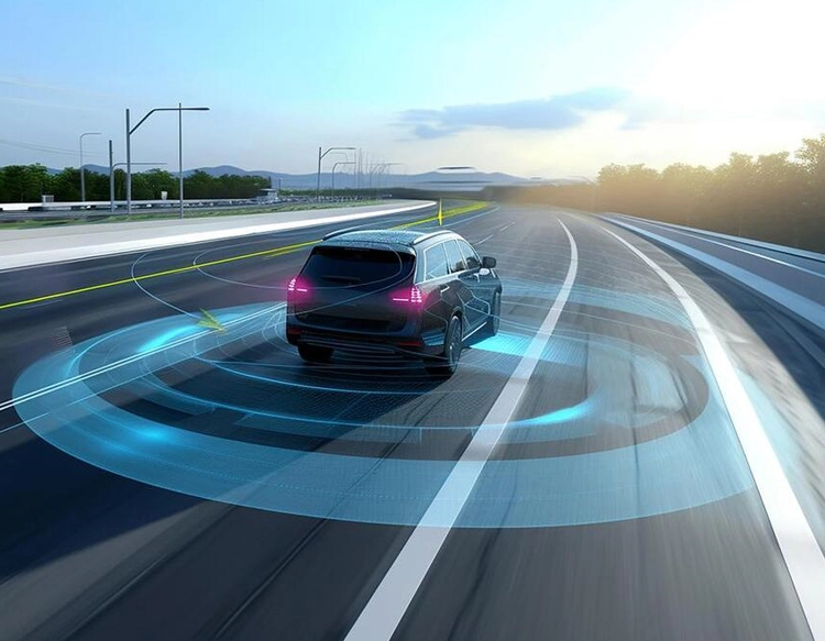
In the automotive industry, lidar distance sensors are a cornerstone of autonomous driving systems. They provide real-time, 360-degree environmental awareness, allowing vehicles to detect obstacles, pedestrians, and other cars with centimeter-level accuracy. This capability is essential for safe navigation, especially in complex urban settings. Companies like Waymo and Tesla integrate lidar with cameras and radar to create robust perception systems, though debates continue over the optimal sensor fusion approach. Beyond self-driving cars, lidar aids in advanced driver-assistance systems (ADAS), enhancing features like adaptive cruise control and emergency braking.
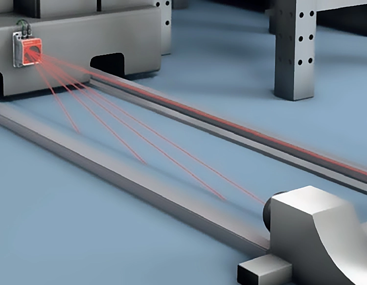
Robotics and automation also benefit significantly from lidar technology. In warehouses and manufacturing plants, robots equipped with lidar sensors navigate dynamically, avoiding collisions and optimizing paths for material handling. These sensors enable precise object recognition and localization, streamlining tasks such as sorting, packing, and assembly. Drones, too, rely on lidar for terrain mapping and obstacle avoidance, supporting applications in agriculture, construction, and disaster response. For instance, farmers use lidar-equipped drones to monitor crop health and plan irrigation, while surveyors create high-resolution topographic maps for infrastructure projects.
Environmental and scientific applications showcase lidar's versatility in remote sensing. Researchers employ airborne lidar systems to study forest canopies, measure glacier thickness, and track atmospheric pollutants. By penetrating vegetation, lidar reveals ground surfaces for archaeological discoveries or flood risk assessment. In urban planning, it helps model cities in 3D, analyzing building heights and solar potential. The technology's ability to operate in diverse conditions—from foggy weather to dark environments—makes it a reliable tool for long-term monitoring and data collection.
Despite its advantages, lidar distance sensors face challenges such as high costs and sensitivity to weather interference like heavy rain or snow. However, ongoing innovations aim to address these issues. Solid-state lidar and frequency-modulated continuous-wave (FMCW) lidar are emerging as cost-effective alternatives, offering improved performance and integration. As production scales up, prices are expected to drop, further democratizing access. Looking ahead, the fusion of lidar with artificial intelligence and 5G connectivity promises smarter, faster systems for smart cities, IoT devices, and beyond.
In summary, lidar distance sensors represent a transformative technology with far-reaching impacts. Their precision and adaptability drive progress in transportation, robotics, environmental science, and more. As research continues to refine their capabilities, we can anticipate even broader adoption, shaping a future where accurate spatial data underpins innovation and efficiency across the globe.